Friday, 26 April 2013

Mt MacDonald - what an adventure!

Recently, I was told about a website that shows hikes and walks that are sometimes not listed on the usual maps. This was quite exciting for me as I love finding new places and making it an adventure to find it and hike it. Well our last hike was just that. I took a few days to figure out a new place I wanted to take my group of hikers and Mt. MacDonald was the choice.

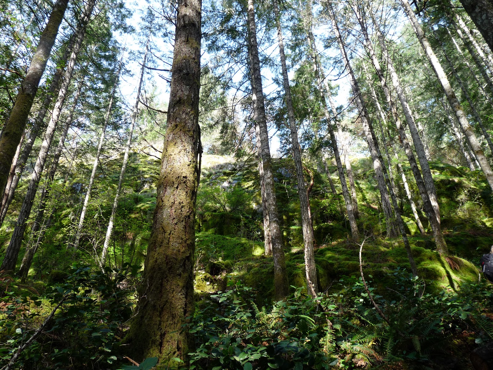
The entrance to the hike is near Mt Wells (close to Goldstream, off of Humpback Road). We all met at the Mt Wells parking lot and walked down the road a bit to find the start of the trail for Mt MacDonald. The trail started to ascend pretty quickly. This was one of the first pictures I took looking up. I just love the beautiful shades of green!


As we hiked, the trail become more and more steep. We came across a part of the trail where it was quite narrow and on a cliff. At this point, we lost some of our group who decided to go another way as they were afraid of heights (and it was 2 of the men!). Sorry guys if you are reading this, however, I just thought that was interesting :-). I did feel a bit responsible in picking this hike, however, there were still about 6 of us that were excited to continue on the narrow route. Here is a picture that is one of my favourite's that shows some of the trail and it's narrow path.


As we climbed, many of us had to stop and take some pictures as the trail truly offered some beautiful scenery. Here are just a couple:


At some point in the trail, we were able to meet up with the others that went another way, although they did have to bushwhack to get back to us.
 
As we approached about 3/4 of the way to the top, we came across a part of the trail where we had to use the hand rope's that thankfully someone placed to get us up. It is difficult to see how steep and difficult it would be without the ropes in this picture. The dogs that were with us were not able to come up so some of us stayed behind and others went up.
 
 
Some of the group had some issue's getting to the top of this and going back down was even harder! When we were sitting at the top of this part of the trail, some of the group expressed interest in turning around and heading back down. It was taking a toll on a few of us so was all for it. Before we headed back down, I took the following pictures of the view:


As we headed back down, it was amazing the view that you miss while climbing up.


All in all, it was a beautiful hike with some difficult terrain. We all made it back down safely and I think everyone felt some sort of accomplishment that day!
 
Onto our next hike...
 
Nicole


Monday, 15 April 2013

Gowlland Tod Park: Emma Dickson trail up to Jocelyn Hill

This is one of my favourite hikes. It's a little difficult to know where this hike starts as it is not clearly marked on the road. Maybe this is one of the reasons it is one of my favourite's? BC parks website offers some great information on this park as well as park maps. Here is the one that shows you where the Emma Dickson trail starts:

http://www.env.gov.bc.ca/bcparks/explore/parkpgs/gowlland_tod/trail_map_middle.pdf

The hike usually takes us about 1 1/2 roundtrip. The trail starts heading up right away so there is no real warming up time. This may be a factor if you don't hike much. The first part of the trail is through moss covered ground and beautiful trees. Once you get onto the main trail, called The Ridge trail, it is more of an up and down trail with more of an emphasis of up. I would say it is a moderate hike. Oh by the way, my group that hike's with me say they don't beleive me anymore when I tell them it is not difficult. So take that into account if you are wondering how difficult it is. I figure you can always stop along the way, take break's and enjoy the view :-)

There are some great lookout points on this trail if it is a sunny day. I have been lucky and most of the times I have done this hike, it has been fairly decent weather. This past Saturday, the rain and wind in Victoria made most of us in our group think it was going to be a nasty day up there. We even had a bailer or two. However, the weather cleared and we ended up with beautiful sunshine!

Here is a view that I never tire of. The view is from The Ridge trail looking down Finlayson Arm. What a beauty heh?


This is from The Ridge trail looking down the other way.


Here are a few photo's from not-such a sunny day...although the fog was starting to clear here.
 
A wee bit different view in the fog

I love the different colours of the moss & trees
 

Even when it is foggy, it is still so beautiful. However, I was so happy to have the sunshine come out last week. When I bring new people to this place and I get to experience their reaction to such a wonderful view, it is just so enjoyable.

There are many trails in Gowlland Tod Park and I highly recommend all of them. Here is some general information from the BC Parks website on Gowlland Tod:

"Gowlland Tod protects a significant part of the Gowlland Range, one of the last remaining natural areas in Greater Victoria, and a significant portion of the natural shoreline and uplands of Tod Inlet. The Gowlland Range is a particularly rich area of biodiversity, with more than 150 individual animal and plant species identified. The protected area preserves a rare, dry coastal Douglas fir habitat that features grassy meadows, rocky knolls and old-growth forest.
The Gowlland Range towers 430 metres over Finlayson Arm, a unique fjord that only replenishes its marine waters once a year. Species that are rare elsewhere in the world flourish in this isolated and stable habitat. The abundance of marine activity attracts scuba divers from around the world, as well as boaters seeking the calm waters and sheltered anchorage of Tod Inlet."

So what hike shall we do next? Hmmm, there are so many to choose from but I think I might just find a brand new one to us all.

Till next time,

Nicole Wilford ~ WildVanIsle Blogger