Friday 1 November 2013

It's been awhile since I have blogged about our experiences on Vancouver Island! It hasn't been because we haven't done anything, quite the opposite. We have done many camping trips over the summer and just did our last camping trip just a couple of weekends ago! Had a great time with some great friends and truly got to enjoy the wilderness out near Port Renfrew. We saw some Elk, Eagles, other birds and a bear. To top it all off, we had an evening clear with a full moon that kept our campsite lit up throughout the evening and night. Unfortunately, I was not able to get pictures of some of these beautiful sights (too hard to get the camera out in time for some of the wildlife and no great shots of a moon with my camera). However, we did camp at a beautiful spot and got some great photo's of the area.

Here is one of our view from our campsite looking over at the other side of the river:
 
Here is the campsite we had with the guys getting the firewood ready:

 
Our last evening there, we saw a bear on the other side of the river:
 
 
So what did we do the next morning? Checked out the area where the bear was! Maybe not the best idea we have had but hey, it was exciting. Here is where the bear was, looking over at our campsite.
 
 
Such beautiful, clear pools! I would live here too if I was a bear :-)
 

It was a great weekend and I sure love being out in the wilderness like this. No phone or internet service, just the peace and quiet of nature. It truly is the best way to recharge!

Until next time,

Nicole

Tuesday 16 July 2013

Camping in Northern Vancouver Island

Three years ago we explored the northpart of Vancouver Island and ever since we have wanted to go back and explore more of it. There are so many lakes and recreation sites to check out. This year we decided to explore the lake area just northwest of Campbell River. A friend of Dan's recommended a lake that will stay unmentioned as I was told that I could not tell others about! So that was our first destination and we would see what we wanted to do from there. We arrived at the lake on a Saturday and were a bit surprised that we had the place to ourselves as there are only two camp spots at this rec site. It is a beautiful lake and very quiet and peacful.

Our first plan of attack was to get our camp set up. Of course you need to have a drink while doing this so out came our assortment of drinks:


Setting up camp with our huge tarp is always a workout. But finally, we were settled. Here is a picture of our camp. Looks pretty good hey?

And our beautiful view...


Our first couple of days here we had a mixture of sunshine, clouds and rain. We went out in our canoe a few times to check out the lake and to fish. We caught some trout but they were too small to keep. Here is a picture of my first catch. You can't actually tell how small this fish was so I could have lied an said it was huge :-).


Here is a view of the lake from our canoe that shows our own private little beach. Peaceful looking isn't it?


Our original thought was to stay a few days and then possibly move on to another area, however, it was such a relaxing place to be we ended up staying for the whole week.

Over the days, we enjoyed many peaceful times. Some days we just hung out at the lake and other times we got into the truck and explored a bit of the area, with a couple of drives into Campbell River for a well needed shower. When I was walking around our campsite area one day, I came across a place where a bear had definately made home. Here is a picture of the bear fur on the left and bear claw marks on the right. We may have scared him away when we arrived as we also saw some very fresh poop!


One day during the week it was so windy we had to hang out on the other side of the truck where the wind wouldn't bother us. During that day, we came to the decison that a very windy day is actually more bothersome than a rainy day. That night we decided if the next morning was just as windy, we would head out on an adventure and explore more of the area. The next morning, waking up to the wind again, we headed out for the day. I have to admit I was almost tempted to pack up the camp and find something less windy, however, that seemed to be too much work! In the end, the wind died by the time we came back that evening.

During our exploration that day we came across many recreation sites and lakes that were just beautiful and definately weren't used all that much compared to our rec sites in the lower Vancouver Island area. We went into Sayward that day as it was a place neither of us had been to before. It is definately a small town with not much going on, however, it sure is situated in a beautiful area.

The rest of the week consisted of enjoying our camp and the lake. Here are a few pictures that show the beauty of the place. If you like exporing and camping with limited services, this area is a great place to feel connected to the wild.


Love the rickety old dock - added to the uniqueness of the place!

Till next time,
Nicole W

Friday 31 May 2013

Beautiful sights and sounds of Vancouver Island!

Here are a few pic's and video of my last couple of weeks out and about.

Recently we went camping on friends land up above Jordan River, which is about 1/2 hour past Sooke on your ways toward Port Renfrew. The view from his land is spectacular although I didn't take the picture of it. However, you can see out over the Juan de Fuca Strait. It was a great getaway and I actually didn't take any pictures while we were there as it was time to take a break from all the technology such as my phone. I did however turn my phone on to record the sounds around us. We were camping right on a small lake and the sound of the frogs were almost deafening. I truly do love the sound of them, however, they actually were so loud around us, I had to wear earplugs to be able to sleep. Here is the video I took where you can see what our view was over the lake and the surrounding sounds of frogs:
http://www.youtube.com/watch?v=Cp2wuasNoNM&feature=youtu.be


Well, love it or hate it? I can't imagine actually hating any nature sounds but there are people out there that don't care for it.

Another time during the past week, I was driving along West Saanich Road and the view of the Patricia Bay and sky was truly beautiful. Here is the picture I took of the evening:

Our hike, well actually a walk, last week was along the beach at Island View Beach. It is not a difficult walk by any means, however, it is a good work out on the legs when you walk along the sand for two hours. There were only four of us that showed up and we were lucky to find that the tide was out. Here is a picture of the beach and the three that joined me:
 Have you walked this beach before? It is a great walk, but be careful if the tide is coming in. We had to cross running water a few times and well most of us got soaked feet. Our guy friend, as you can see in the above picture, is quite tall so needless to say, he didn't seem to have an issue with it but us shorty's did! We ended up getting back up to the higher part of the beach and walking a fair distance down the beach and turned around and walked back. All in all it took about 2 hours and you could make the walk even longer if you wanted to. One of my favourite views from this beach is the view across to one of the private  islands called James Island. Here is the view:

Well that is it in a nutshell for this week. We are headed out to climb Mt Wells tomorrow so I am sure I will have some great photo's and hopefully some good stories to share with you next week.

Nicole

Thursday 16 May 2013

Mt Finlayson - conquering my long time fear!

I have lived in the Greater Victoria area for more than 27 years and yet I had never hiked Mt Finlayson till just recently. Mainly because I always felt I was never in good enough shape but also because I had heard about how hard the hike was many years ago and I've had that fear ever since. Well I finally decided to face my fear and take our hiking group up there. Yes I was making my group face my fear with me. Well technically I wasn't "making" them, but they always know they will be talked about if you they don't go (haha). I figured we were ready and fit for it now since doing some more difficult hikes recently. That's the fun part about organizing these hikes, I get to decide what to do and my group just blindly follows - right my lovely hiking friends? ;-)

There ended up being 10 of us on this hike which surprised me as I had a *WARNING* in my email to everyone earlier that week that it was going to be difficult and possibly not good for people with height issues. We started up the trail and it was a constant uphill climb from the get go. There really was no break in the climb except for an area where we climbed down a gully area to cross a bridge and start climbing right back up! The following two pictures show some of us climbing down this gully on roots of the trees. It was a bit of tricky foot work.


...and here is the bridge then up the other side!

As we climbed further up, we came across some rocky area's where you had to figure out what way was best for footing. Here is a picture of our group at one of these rocky area's.


Part of the way up, one of our hikers had to end up turning around and heading back due to some foot issues she was having. Then shortly after that, we "lost" another hiker (okay we didn't lose her) as she was not able to go any further due to her fear of heights. It was when we were just emerging from the treeline and started to climb just on rocks with the spectacular but a bit scary view! Here is a picture of the trail where our hiker could no longer go any further. Our friend Cindy in the front and me holding onto the rock while passing this narrow ledge.

The rest of us continued upwards, now down to 8 hikers! We were losing them like flies. I myself was not feeling all that great. I kept feeling like I was going to lose my cookies so to speak. It was a hard hike but I have exerted myself like this before and didn't feel like this. However, my fear of heights was also starting to get to me. I don't have it as bad as others, but there are times that it can get to me. As we continued upwards, I started to feel a bit dizzy - not a good thing to feel on a rock edge! I said to my group "I think I am going to throw up". They of course figured I was not really being serious until I made my way over to a place that was out of the way and well, I really don't need to tell you the rest - especially if you are eating while reading this! Let's just say, I did what I had to do and I actually felt way better, so I continued upwards. I realized after that episode that I really should not have eaten bacon and eggs that morning. Duh, what was I thinking?

Here is a picture of Dan and I near the summit. This gives you a good perspective of how high we were. The building and golf course behind us is Bear Mountain.

And finally at the top! Our group of 8. Ahhhh....it felt good!


On our descent, we went back down the backside of the mountain. Many of us were glad we did as the thought of going back down the face of the mountain was just too scary! The backside is a casual descent through the trees and back down onto Finlayson Road. We had to walk down this narrow road with cars driving past us which was not the best place to be. It was our only choice though to get back to our vehicle's....well unless we wanted to go back up the Mountain and down the other side! Ha, that was not going to happen.

All in all it was a difficult hike but we did it and it felt like a great accomplishment. I don't think we will do it again anytime soon but maybe down the road to see how well we do next time. If you are afraid of hikes and worried about hiking up this mountain, you could go up the backside which would be a good work out but not as scary!

This week we are going camping for the long weekend so no hiking but maybe I will share some pics and stories about our camping trip next.

Until then, 

Nicole

Friday 26 April 2013

Mt MacDonald - what an adventure!

Recently, I was told about a website that shows hikes and walks that are sometimes not listed on the usual maps. This was quite exciting for me as I love finding new places and making it an adventure to find it and hike it. Well our last hike was just that. I took a few days to figure out a new place I wanted to take my group of hikers and Mt. MacDonald was the choice.

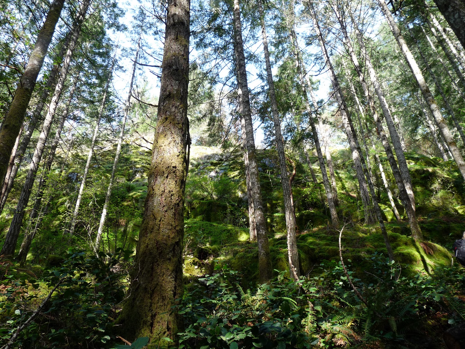
The entrance to the hike is near Mt Wells (close to Goldstream, off of Humpback Road). We all met at the Mt Wells parking lot and walked down the road a bit to find the start of the trail for Mt MacDonald. The trail started to ascend pretty quickly. This was one of the first pictures I took looking up. I just love the beautiful shades of green!


As we hiked, the trail become more and more steep. We came across a part of the trail where it was quite narrow and on a cliff. At this point, we lost some of our group who decided to go another way as they were afraid of heights (and it was 2 of the men!). Sorry guys if you are reading this, however, I just thought that was interesting :-). I did feel a bit responsible in picking this hike, however, there were still about 6 of us that were excited to continue on the narrow route. Here is a picture that is one of my favourite's that shows some of the trail and it's narrow path.


As we climbed, many of us had to stop and take some pictures as the trail truly offered some beautiful scenery. Here are just a couple:


At some point in the trail, we were able to meet up with the others that went another way, although they did have to bushwhack to get back to us.
 
As we approached about 3/4 of the way to the top, we came across a part of the trail where we had to use the hand rope's that thankfully someone placed to get us up. It is difficult to see how steep and difficult it would be without the ropes in this picture. The dogs that were with us were not able to come up so some of us stayed behind and others went up.
 
 
Some of the group had some issue's getting to the top of this and going back down was even harder! When we were sitting at the top of this part of the trail, some of the group expressed interest in turning around and heading back down. It was taking a toll on a few of us so was all for it. Before we headed back down, I took the following pictures of the view:


As we headed back down, it was amazing the view that you miss while climbing up.


All in all, it was a beautiful hike with some difficult terrain. We all made it back down safely and I think everyone felt some sort of accomplishment that day!
 
Onto our next hike...
 
Nicole


Monday 15 April 2013

Gowlland Tod Park: Emma Dickson trail up to Jocelyn Hill

This is one of my favourite hikes. It's a little difficult to know where this hike starts as it is not clearly marked on the road. Maybe this is one of the reasons it is one of my favourite's? BC parks website offers some great information on this park as well as park maps. Here is the one that shows you where the Emma Dickson trail starts:

http://www.env.gov.bc.ca/bcparks/explore/parkpgs/gowlland_tod/trail_map_middle.pdf

The hike usually takes us about 1 1/2 roundtrip. The trail starts heading up right away so there is no real warming up time. This may be a factor if you don't hike much. The first part of the trail is through moss covered ground and beautiful trees. Once you get onto the main trail, called The Ridge trail, it is more of an up and down trail with more of an emphasis of up. I would say it is a moderate hike. Oh by the way, my group that hike's with me say they don't beleive me anymore when I tell them it is not difficult. So take that into account if you are wondering how difficult it is. I figure you can always stop along the way, take break's and enjoy the view :-)

There are some great lookout points on this trail if it is a sunny day. I have been lucky and most of the times I have done this hike, it has been fairly decent weather. This past Saturday, the rain and wind in Victoria made most of us in our group think it was going to be a nasty day up there. We even had a bailer or two. However, the weather cleared and we ended up with beautiful sunshine!

Here is a view that I never tire of. The view is from The Ridge trail looking down Finlayson Arm. What a beauty heh?


This is from The Ridge trail looking down the other way.


Here are a few photo's from not-such a sunny day...although the fog was starting to clear here.
 
A wee bit different view in the fog

I love the different colours of the moss & trees
 

Even when it is foggy, it is still so beautiful. However, I was so happy to have the sunshine come out last week. When I bring new people to this place and I get to experience their reaction to such a wonderful view, it is just so enjoyable.

There are many trails in Gowlland Tod Park and I highly recommend all of them. Here is some general information from the BC Parks website on Gowlland Tod:

"Gowlland Tod protects a significant part of the Gowlland Range, one of the last remaining natural areas in Greater Victoria, and a significant portion of the natural shoreline and uplands of Tod Inlet. The Gowlland Range is a particularly rich area of biodiversity, with more than 150 individual animal and plant species identified. The protected area preserves a rare, dry coastal Douglas fir habitat that features grassy meadows, rocky knolls and old-growth forest.
The Gowlland Range towers 430 metres over Finlayson Arm, a unique fjord that only replenishes its marine waters once a year. Species that are rare elsewhere in the world flourish in this isolated and stable habitat. The abundance of marine activity attracts scuba divers from around the world, as well as boaters seeking the calm waters and sheltered anchorage of Tod Inlet."

So what hike shall we do next? Hmmm, there are so many to choose from but I think I might just find a brand new one to us all.

Till next time,

Nicole Wilford ~ WildVanIsle Blogger